Pielke Jr.: Europe’s Deadly Aversion to Air Conditioning: ‘Tens of thousands die in European summers for want of a technology the rest of the rich world takes for granted’ June 26, 2026
Meteorologist: European heatwave ‘has nothing whatsoever to do with climate change or greenhouse gas emissions’ June 26, 2026
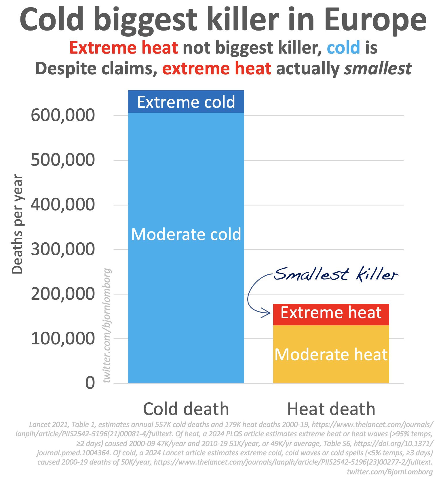
Bjorn Lomborg: ‘While the media focuses on Europe’s heatwave: Remember, cold kills far more Europeans than heat’ – ‘Extreme heat is the smallest temperature-related killer’ June 26, 2026
The Problem With Suing Oil Companies for the Weather – ‘It is insane to try to connect a heatwave, or any bad weather, to a particular oil producer’ June 25, 2026