https://electroverse.net/arctic-april-grips-in-north-america/

“ARCTIC APRIL” GRIPS NORTH AMERICA BREAKING HUNDREDS OF ALL-TIME COLD RECORDS
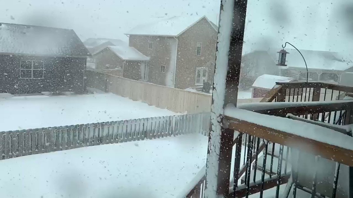
Record cold and snowfall hit many parts of North America over the Easter weekend, continuing what has so far been a largely Arctic April.
Records were toppled across many U.S. states, with Montana, Iowa, South Dakota, and Colorado seemingly worst hit.
A winter storm system moved through Iowa on Sunday delivering between three inches and a foot to the majority of locations — several northern Iowa towns saw their all-time records tumble:
The 3.7 inches reported at Sioux Gateway Airport broke the record for April 12th; it also made it the second highest Easter snowfall ever behind the 4.7 inches during Easter 1929.
The town of Ringsted in Emmet County (also Iowa) came in with a record-busting 11 inches. Robert “Lightning” Petersen was the man to logged the new record — he uses his back yard to park measuring equipment to keep track of snowfall, and rainfall. He works in concert with the National Weather Service out of Johnston.
When the snow fell on Easter Sunday, he checked his 12-inch gauge and was shocked to discover the almost 1 foot total, reports whotv.com/news.
“I was flabbergasted because it was not a blizzard activity during the day,” said Petersen. “But holy smokes, when I got that gauge up on the deck, it was plum full. I thought it can’t be. I must be seeing things.”
According to the National Weather Service (NWS), other Eastern snowfall records tumbled in Rock Valley (7 inches), Hull (6.5 inches), and Rock Rapids (8.3 inches).
Nearby Sioux Falls, South Dakota saw a whopping 5.2 inches on Monday, the most snowfall on any date in the city going back to 1893.
Matthew Dux@MatthewDux

Denver’s Monday morning low temperature of 16F broke the city’s record for coldest April 13 ever, with snow expected throughout the week.
The cold record, which was set at Denver International Airport –the official recording site for Denver– eclipsed the previous record of 17F set way back in 1933, the NWS confirmed in a Tweet:
NWS Boulder
✔@NWSBoulder

The all-time record for ‘coldest high temperature’ also fell on Monday — the 27F set back in 1933 was ousted by a full two degrees:
NWS Boulder
✔@NWSBoulder
A RECORD LOW MAXIMUM TEMPERATURE OF 25 DEGREES WAS SET AT DENVER CO TODAY. THIS BREAKS THE OLD RECORD OF 27 SET IN 1933.#cowx
Trawling through the NWS Boulder’s Twitter feed, this snowfall nugget also emerged: Boulder has already had 134.3″ of snow this season — the 5th largest accumulation on record:
NWS Boulder
✔@NWSBoulder
Boulder has had 134.3″ of snow this season which is now the 5th most on record. #cowx

The story was all-too similar in and around Rochester, MN.
It was an Easter snowstorm residents of southeast Minnesota will be talking about for some time, reads a krocnews.com article.
Rochester’s official total at the city airport was 7.5 inches. That pipped the previous record for April 12 –7.2 inches, 1962– and also made it the city’s 4th snowiest April day of all-time.
The NWS reported even heavier falls in Elgin (10.8 inches), Wabasha (10 inches), and the Oronoco area (9.7 inches).

Winter is also proving hard to shake in Wyoming.
A long-standing weather station southeast of Gillette observed a low of 4F on Monday morning, according to NWS meteorologist Matt Bunkers. That low smashed the previous all-time daily record low of 9F set in 1997, in books dating back 118 years, to 1902.
NWS Rapid City
✔@NWSRapidCity
Record low temp of 4 F at 4 miles ESE of Gillette, #WYwx, this morning; breaks old record of 9 F set in 1997.


Bunkers said dipping 5 degrees below a previous record, especially in the month of April, is “interesting to witness”. Looking forward, he added that winter will hold a tight grasp on the region throughout the week. Monday night’s low is projected to be 8F, with area thermometers not expected to top 40F until Saturday.
Tuesday’s all-time record low is 7F, set in 1986.
In addition, heavy snow was headed Gillette’s way over the Easter weekend, triggering a level 1 Snow Emergency:
City of Gillette@CityofGilletteWe have more winter weather headed our way. In anticipation of that, we are declaring a Level 1 Snow Emergency. It will be effective on Saturday, April 11th at 6 am. This means that vehicles must be removed from designated Snow Emergency Routes by 10 am. on Saturday. #GilletteWY


There was also numerous cold records busted north of the border.
The city of Kamloops, British Columbia suffered -3.9C on Sunday morning , tying the coldest ever recorded temperature on April 12 which was set back in 1971.
“We had a pretty significant cold front go through the province this weekend,” said Environment Canada meteorologist Lisa Erven. “There was even some low elevation snow fall.”

The COLD TIMES are returning, the lower latitudes (where us humans reside) are REFREEZING; in line with historically low solar activity, cloud-nucleating Cosmic Rays, and a meridional jet stream flow.
Even NASA agrees, in part at least, with their forecast for this upcoming solar cycle (25) revealing it will be “the weakest of the past 200 years,” with the agency correlating previous solar shutdowns to prolonged periods of global cooling here.


Don’t fall for bogus warm-mongering political agendas — our future is one of ever-descending COLD & CROP LOSS.
Prepare accordingly — learn the facts, relocate if need be, and GROW YOUR OWN.
Social Media channels are restricting Electroverse’s reach — be sure to subscribe to receive new post notifications by email (the box is located in the sidebar >>> or scroll down if on mobile).
And/or become a Patron, by clicking here: patreon.com/join/electroverse
The site receives ZERO funding, and never has.
Any way you can, help us spread the message so others can survive and thrive in the coming times.
Grand Solar Minimum + Pole Shift